 RECHARGE TO GROUND WATER IN SOUTHEASTERN
WISCONSIN RECHARGE TO GROUND WATER IN SOUTHEASTERN
WISCONSIN
The
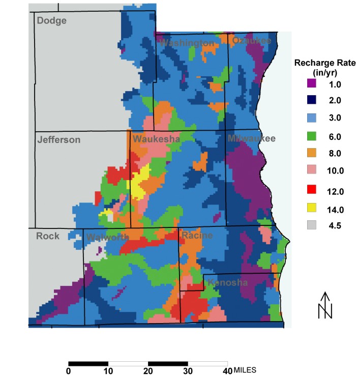
recharge entering the ground-water system is not uniform across southeastern
Wisconsin. A study at the University of Wisconsin Milwaukee calculated the pattern
of recharge rates for southeastern Wisconsin. These rates were used in the ground-water
model. Recharge is generally less near Lake Michigan where clayey glacial till
deposits are in the subsurface. It is higher in the Kettle Moraine area in western
Waukesha County where deposits are sandier. The distribution of recharge affects
the location of source areas for wells.
Land uses changes (for example, the spread of pavement)
can change the recharge pattern. So can climate changes (for example, less freezing
of soils due to global warming). These effects are very hard to quantify.
For more information on the recharge study, see
Cherkauer, D.S., 2001, "Distribution
of ground-water recharge in southeastern Wisconsin": Unpublished
final report to Source Water Protection Program, Wisconsin Department of Natural
Resources. 31 p.
Also see, Cherkauer, D.S., 2004, "Quantifying Ground Water Recharge
at Multiple Scales Using PRMS and GIS": Ground Water, Vol. 42,
No. 1.
|