NATURAL DISCHARGE OF GROUND WATER 
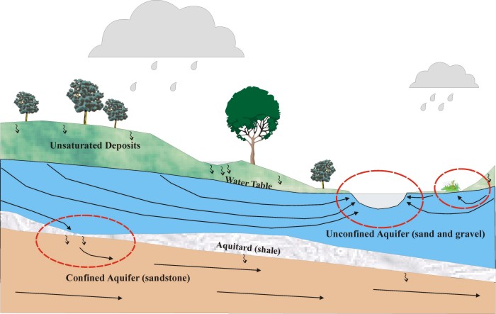
Under natural conditions ground water discharges mostly to surface-water bodies. The diagram below shows two discharge areas - one a stream or lake, the second a wetland. Both are connected to the shallow, unconfined, water-table aquifer.
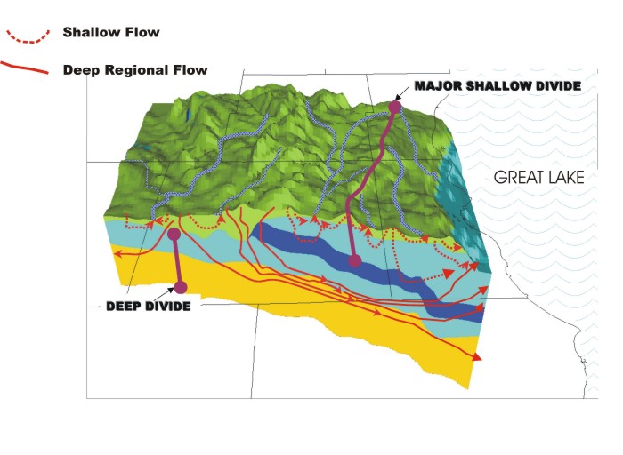
The leakage of water down from a shallow part of the ground-water flow system through
confining units to a deeper part of the flow system can be seen as a kind of internal
discharge. Ultimately, this leakage moves laterally and discharges to regional surface
sinks like a Great Lake:
Sample ground-water flow lines that discharge to a Great
Lake are shown in the following VIDEO CLIP (3394 kb). It contains
a three-dimensional view of selected ground-water
flow lines circulating from the water table toward the Lake. The colors
along the flow lines
correspond to minimum estimated times of travel in years.
Most of the flow lines originate near the coastline and discharge upward to the
Lake, but
some originate further inland or leak to deep formations and flow under the Lake
to the east.
To next concept --> Surface-water
and natural ground-water divides |