Protecting Wisconsin's Groundwater Through Comprehensive Planning
Image placeholderLearn more about groundwaterIntegrate groundwater into your planFind data and polices in your areaBrowse for additional resourcesChecks
Find data and polices in your area
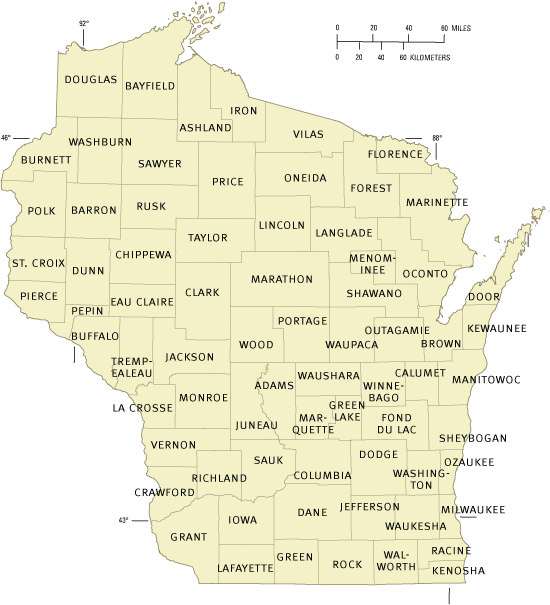
  CLICK ON THE MAP OR COUNTY NAME TO ACCESS DATA AND POLICIES.
The Find Section provides the most current information and data found as of May 2007, unless otherwise noted.
 
Ashland County Map of Wisconsin showing counties Adams County Brown County Oconto County Barron County Bayfield County Ashland County Buffalo County Dane County Burnett County Columbia County Crawford County Clark County Calumet County Chippewa County Dodge County Door County Douglas County Eau Claire County Fond du Lac County Dunn County Green County Jackson County Green Lake County Jefferson County Iowa County Florence County Forest County Iron County Juneau County Kenosha County Kewaunee County Lincoln County La Crosse County Lafayette County Langlade County Manitowoc County Marquette County Marathon County Marinette County Milwaukee County Oneida County Outagamie County Ozaukee County Monroe County Polk County Portage County Pepin County Pierce County Grant County Richland County Price County Racine County Menominee County Rusk County Rock County Sawyer County Shawano County Sauk County Sheboygan County Vilas County Taylor County St. Croix County Trempealeau County Vernon County Washburn County Wood County Waupaca County Waushara County Winnebago County Washington Waukesha County Walworth County
   
 
Adams Douglas Kewaunee Ozaukee Taylor
Ashland Dunn La Crosse Pepin Trempealeau
Barron Eau Claire Lafayette Pierce Vernon
Bayfield Florence Langlade Polk Vilas
Brown Fond du Lac Lincoln Portage Walworth
Buffalo Forest Manitowoc Price Washburn
Burnett Grant Marathon Racine Washington
Calumet Green Marinette Richland Waukesha
Chippewa Green Lake Marquette Rock Waupaca
Clark Iowa Menominee Rusk Waushara
Columbia Iron Milwaukee St. Croix Winnebago
Crawford Jackson Monroe Sauk Wood
Dane Jefferson Oconto Sawyer  
Dodge Juneau Oneida Shawano  
Door Kenosha Outagamie Sheboygan  
         

return to top


For more information about this site, its contributors, and the data contained herein, click here.

For assistance concerning comprehensive planning, please contact Lynn Markham, UW-Stevens Point.
For assistance concerning groundwater, please contact Charles Dunning, USGS.
Page contact: Anne Moser, USGS
Page last updated: September 30, 2007